Monday, November 30, 2015

Utah Powder Days

Ski the greatest snow in the world! I will be in Salt Lake from December through early April. Come experience the easy access, big vert, touring circuit that is the one and only Wasatch Mountains in the winter. All trips are guided through Utah Mountain Adventures.


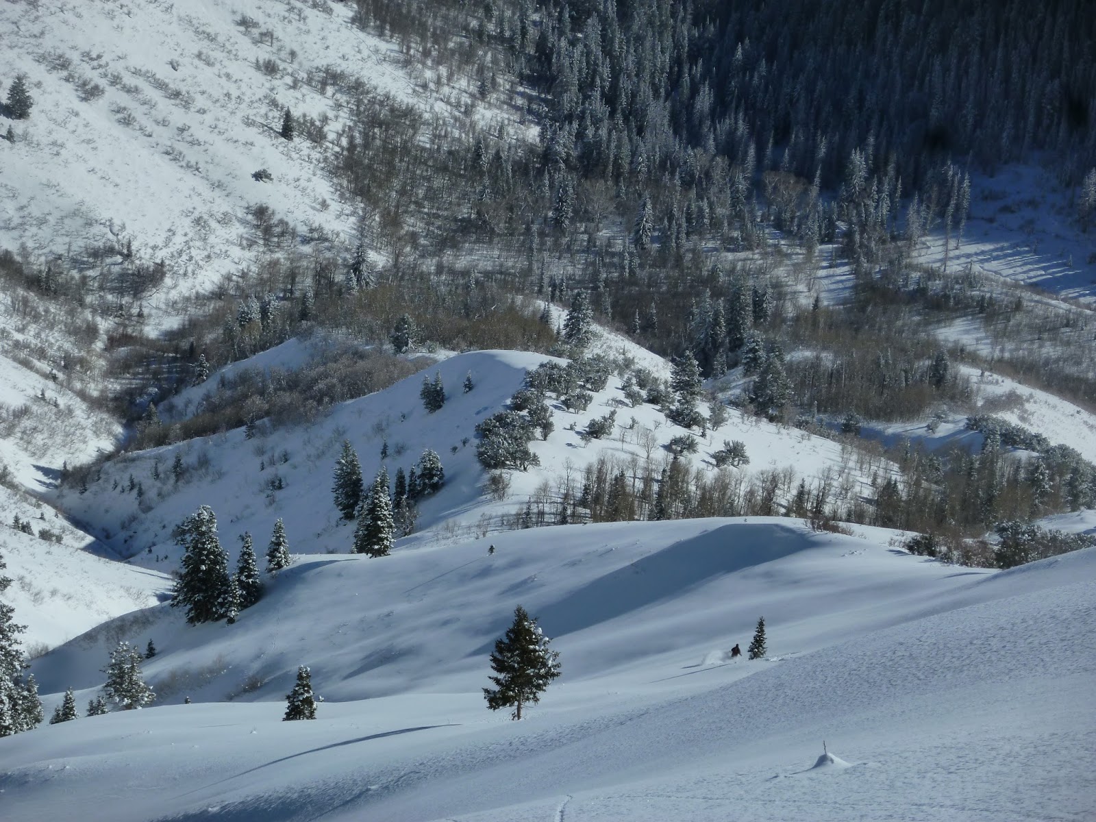
One-ride lift access to off piste laps out of Alta or Brighton. We ride a lift to the ridge line, then ski out of bounds from there. This is the easiest option, exertion wise. Must be able to walk uphill a couple hundred vertical feet at a time in between laps. Session the likes of Dry Fork, Rocky Point, Wolverine Peak, Wolverine Cirque, and Patsy Marley.


Anthony finding the goods as Vanessa sets up for the shot.

The ever popular "Bi-Canyonal". When we drop a car off at the Big Cottonwood Park n Ride, then ride the UTA bus, or hitchike up to the town of Alta. We'll find our way into the so affectionately called "Northern Powder Circuit" aka NPC. The awesome benefit of climbing 800-1200 vertical feet of south facing slopes is handsomely rewarded by dropping in from the top of some high north facing cirques. We'll work our way over passes and down the ridgelines, finding stash after stash of classic open bowls to steep and tight couloirs. The day ends with a dramatic ski down canyon and into lower Big Cottonwood, where we hitchike back to the lot. Beers at the Porcupine Grill are also recommended.

Cardiac Ridge, a classic Wasatch ski zone.


Ski Mountaineering
Consult with Matt to decide upon the best option based on your hopes and dreams, and the conditions of course! Want to ski the Pfeifferhorn? How about the Y Couloir? Or Mt. Timpanogos? Just let me know and lets make that happen.

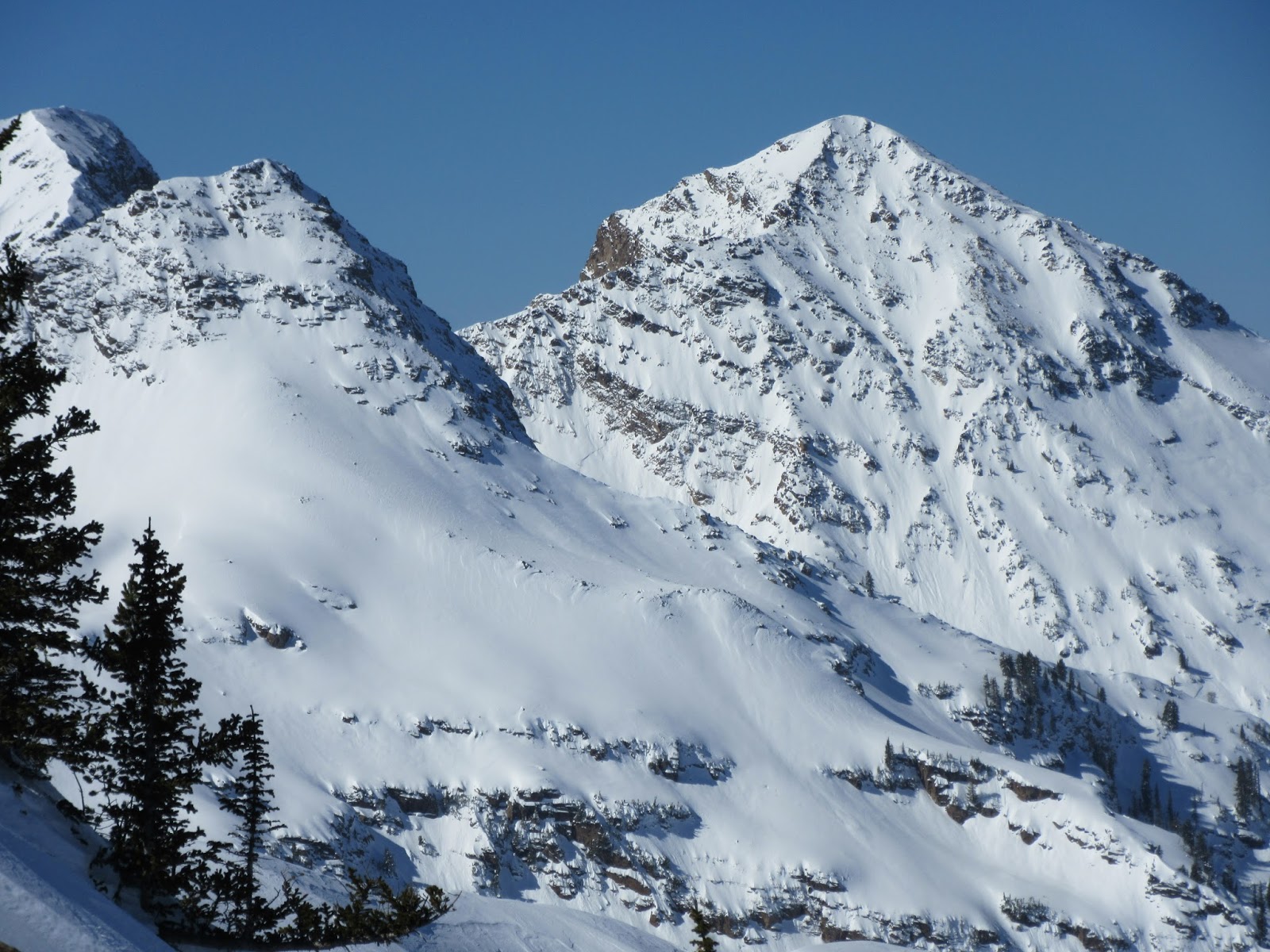
Dromedary and Twin Peaks, both excellent objectives for the aspiring ski or snowboard mountaineer.


Matt is a great instructor and you can expect to learn about the following skills as "teachable moments" arise in the field:
Current snowpack and avalanche situation
Snowpack evaluation
Navigation
Routefinding and track setting
Uphill ski/splitboard techniques
Downhill ski/splitboard techniques
Tips and tricks


Tuesday, February 17, 2015

Long Live American Fork Canyon!


Backcountry skiing in the Lone Peaks Wilderness area of upper American Fork. If this deal went through, the ~100 person per day count that visit this area in winter could shoot up to 10,000+ persons per day in the nearby vicinity...
 
I’m talking about American Fork Canyon people. Ya know it? Maybe so, maybe not. But just because you may not ever go to the upper reaches of this watershed in the winter or summer, does that mean it’s all good to allow public land managers to sell off and sell out to privatized corporations, who will then develop,build, sell, and trash our once public lands??? This is concurrently a huge issue elsewhere in the great state of Utah. See Great Public Lands Gamble Here.

As all eyes turn to the Cottonwood Canyons scenario for Mountain Accord, I hope to gain your attention to the south.
For starters, the Uinta Wasatch-Cache National Forest has been swapping land with private entities recently like hot cakes. It’s as if they are all sitting around at a monopoly game, only the money is real, and the land, the mountains, the railroads, they all will be changed. You can’t just trade land like that, can you? Why wouldn’t they (USFS) hold their ground and LEASE portions of the forest out via SPECIAL USE PERMITs for seasonal operations, continue to manage these lands in an appropriate fashion, and even make some money on them? This would make way more sense. It would first allow a complete, and thorough evaluation process to happen before any “Connecticut Avenue” for your “Reading Railroad”.


Are we really in such a Do or Die decision making process, like the introduction of “Speed Die” (From Wikipedia: “First included in Monopoly: The Mega Edition Variant, this six sided die is rolled with the other two, and accelerates gameplay when in use”). Does anyone else think that its not such a great idea to make such important, future carving land swaps that will last for hundreds of years, in the timeframe of a couple o’ weeks?? I know how you’re going to answer me, Mountain Accord, “The greater SLC metropolitan area is going to double its population in the next 50 years!”, but that means we have 2,600 weeks until that happens…not 2.

Yes, you can find a brief "breeze through" of this information on the Mountain Accord’s “Proposed Cottonwood Canyons Scenario for Public Consideration” and it reads like this:

In return for placing these land holdings into public ownership and protection, the Ski Areas would propose and benefit from: (my comments in Italics)
1. Station stops on a mountain-rail system which would provide reliable, fast, unique, and marketable transit to the resorts and to major dispersed recreation access points. The canyon road would still be open to vehicular traffic.
2. Approximately 258 acres for base-area management and future development (with new culinary water for up to 108 units at Alta) to support activity at transit stops.
3. Additional water for snowmaking. Water is a major issue.
4. Ski permit boundary expansions of 210 acres (140 in Hidden Canyon, 70 in lower Silver Fork).
5. Approximately 416 acres in American Fork Canyon. Hmm, lets take a little closer look at this one.

In addition to the possible privatization of OUR public lands in Salt Lake County, my big beef is with 
#5. Proposal #5 is off the map, both literally and figuratively. It lies in Utah County, where who knows what’s going on, but those few higher ups in those agencies involved (likely Snowbird, USFS, Utah County, and surely a handful of wealthy capitalists). Utah county is set to boom like no other, and is already well along in that process. A major base development and privitized McMansion Village in the upper reaches of AF is ever closer to being a done deal.

Somethings fishy here...Public Lands Under Consideration to become Private? And its faded out and off the map...

Pissed yet? You should be.

Diving deeper, we find this ain't the first time that the 'bird has tried to slide a quick one under the radar. The Hidden Peak structure has been a topic of discussion recently, and quite the eyesore. See 7/2014 Salt Lake Tribune article Here. They tried to add in a tram from the top of Hidden Peak into American Fork as an amendment to their existing and approved Master Plan.

Lastly, I say if there’s a train up LCC and BCC, do we really need a base area, which would be more like a privately owned village up American Fork Canyon, one of the last unspoiled gems of the Wasatch? This is a place where right now you can go and experience vast Wilderness, untracked powder slopes for weeks, real exploration, unnamed ski runs, even a few remaining possible “first descents”, a canyon with no major developments and virtually no light pollution? Should capital gains for private investors (the "economy" as some politicians like to so blindly put it) even be considered a possible trade for OUR PRISTINE PUBLIC LANDS? It’s time gain the momentum and stop that corporate entity that is about to eat up some of the few small pieces of unspoiled mountains that we have left.


Just a few of the many wilderness views in American Fork.

If you think this is totally bogus, you should DO something, don’t just hit “like”. Conservation doesn’t happen by itself.  Comment about the “416 Acre Land Swap in American Fork Canyon” to the Mtn Accord  by emailing HERE.

Go to the Mtn Accord meetings (Especially tomorrow, the 18th of February! But where is the info on the Utah County version of Mtn Accord?)


Mountain Accord Public Q&A’s/Open Houses
  • February 18, 2015
  • Salt Lake City Library
    210 East 400 South, SLC UT, 84111
    Cottonwood Canyons Scenario Discussion: 3-5 p.m.
  • February 23, 2015
  • Our Lady of the Snows
    10189 Utah 210, Alta, UT 84092
    Open House: 5-7 p.m.
  • February 24, 2015
  • Black Box Theater, Eccles Center for the Performing Arts
    1750 Kearns Blvd., Park City, UT 84060
    Executive Board Q&A: 6 – 7:30 p.m.
    Open House: 7:30 – 8:30 p.m.
  • February 25, 2015
  • Skyline High School
  • 3251 East 3760 South, Salt Lake City, UT 84109
  • Open House: 6 – 8:30 p.m.
  • February 26, 2015
  • Wasatch County Senior Center
    465 East 1200 South, Heber, UT 84032
    Community Meeting: 6 – 7:30 p.m.


Talk to people, spread the word. What a shame it would be to see this gorgeous place turn into yet another Deer Valley, The Colony, etc.
 

Friday, December 19, 2014

The Second "Main Event"

Well, it has been a while now since the first main event. The second comes just in time for the winter solstice and the holidays. Since the first one, we've had a lot of clear skies, warm temperatures, then a handful of weak storms getting a bit colder with each one...until now.
The second event of the season will come in early Sunday morning, and last through Monday afternoon. It will feature a gradual warming trend, is associated with an Atmospheric River of moisture, and will be underscored by waves of dense snowfall, with increasing density (and rain at mid to low elevations), with the heaviest precip rates coinciding with the strongest winds (70+ mph on the ridges).

Below is a Meteogram from the GFS Model at SLC. Notice the thick grey line that says "FR"? That indicates the freezing level, to the left of the graph are heights in millibars. For reference 700mb is usually around 10,000ft. above sea level. The higher the mb, lower the elevation, and vice versa. Unfortunately, temperatures get quite warm.


Yesterday's National Weather Service Forecast Discussion was a classic..

"WARM AIR ADVECTION AT 700MB WILL STRENGTHEN SATURDAY NIGHT...ABOUT  
  THE SAME TIME DEEP MOISTURE STARTS TO ARRIVE OVER NORTHERN UTAH.  
  THIS WILL BE THE BEGINNING OF A PROLONGED WET PERIOD FOR NORTHERN  
  UTAH. HOWEVER...WARMING AIRMASS WILL LEAD TO HIGHER SNOW LEVELS WITH  
  MOST VALLEYS SEEING RAIN AND MOUNTAINS RECEIVING RELATIVELY HIGH- 
  DENSITY SNOW. 
   
  && 
   
  .LONG TERM (AFTER 00Z MONDAY)...IMPRESSIVE ATMOSPHERIC RIVER /AR/  
  EVENT PUNCHING INTO THE OREGON COAST WILL TRANSLATE SOUTHEAST AND  
  PEAK OVER THE NORTHERN THIRD OF THE FORECAST AREA SUNDAY INTO  
  MONDAY. ORIENTATION AND LOCATION OF THE AR SUCH THAT VAPOR TRANSPORT  
  WILL REMAIN QUITE SOLIDIFIED INTO THE INTERIOR MTN WEST 
  ...NAEFS MEAN INTEGRATED WATER VAPOR TRANSPORT VALUES CURRENTLY  
  FALLING WITHIN A 15 TO 30 YEAR RETURN INTERVAL LOCALLY FOR THIS TIME  
  OF YEAR. NOTEWORTHY. THE STRONG UPPER JET AXIS AIDING INFLUX REMAINS  
  NORTHEAST ACROSS WESTERN WYOMING IN GUIDANCE HOWEVER...BUT STILL A  
  SOLID 135 KNOTS ALOFT ACROSS NORTHERN UTAH. WAA PEAKING COINCIDENT  
  WITH PEAK PWAT...0.7 INCHES SUN NIGHT...A KEY TO THE PROLONGED  
  PERIOD OF ASCENT UPGLIDE AND PRECIP FORECAST ACROSS THE NORTH  
  THROUGH THAT TIME. VERTICAL PROFILES IN BUFR SOUNDINGS REMAIN QUITE  
  STABLE THROUGH THIS EVENT...BUT ANOMALOUS MOISTURE COMBINED WITH AT  
  LEAST SOME DYNAMIC LIFT WITHIN NORTHWESTERLY FLOW ALOFT IS OWING TO  
  INCREASED CONFIDENCE OF THE BULLISH STORM TOTAL QPF REFLECTED IN  
  GUIDANCE...IN EXCESS OF 2 INCHES SOME NORTHERN MOUNTAIN AREAS.  
  CONFIDENCE OF REALIZING OR EXCEEDING THIS REMAINS HIGHEST FOR THE  
  MTNS NORTH OF I-80 THOUGH SOME AREAS FAVORED BY NORTHWEST FLOW IN  
  THE CENTRAL WASATCH COULD SEE SIMILAR VALUES. WAA ADVECTION PEAKS H7  
  TEMPS TO NEAR -2 C...THUS RAIN/SNOW LINE THROUGHOUT THE BULK OF THE  
  EVENT SHOULD HOVER AROUND 7500 FEET. CONTINUED TO BUMP POPS IN THE  
  NORTHERN MTNS AND UPPED QPF IN REGARDS TO THIS THINKING. -CHENG/MERRILL"

Look at that, integrated water vapor transport values fall within a 15 to 30 year return interval!

Check out the 250mb wind speeds, getting into the 160-170kt range! It is like an arm of an outstretched  basketball player slam dunking right onto us! Like the current of a wide lazy river where the ripples form over the current, ripples of disturbances flow through this, and each one will provide enhanced dynamics for lifting air and therefore, precip.
 
Check out the water vapor transport forecast, very colorful indeed.

Total precip accumulation with the GFS looks to be 2 to 2.5" in the Central Wasatch. But remember, the GFS uses a large grid that doesn't take terrain into account very well at all, and this storm will be highly influenced by terrain lifting. My thoughts are that places with preferred orographics on a WNW flow could easily see twice that amount.


Avalanche danger will very likely reach High by Monday, and it will surely take some time to settle down afterwards. Our snowpack is generally thin, weak, and faceted, including numerous faceted layers (and just low density layers of big stellars) that could be a problem once a slab is stacked on top. Here comes our slab.

In the longer range, it looks like a fairly strong cold front will slide through on Xmas.